Train Derailment Evacuation Planning in London ON
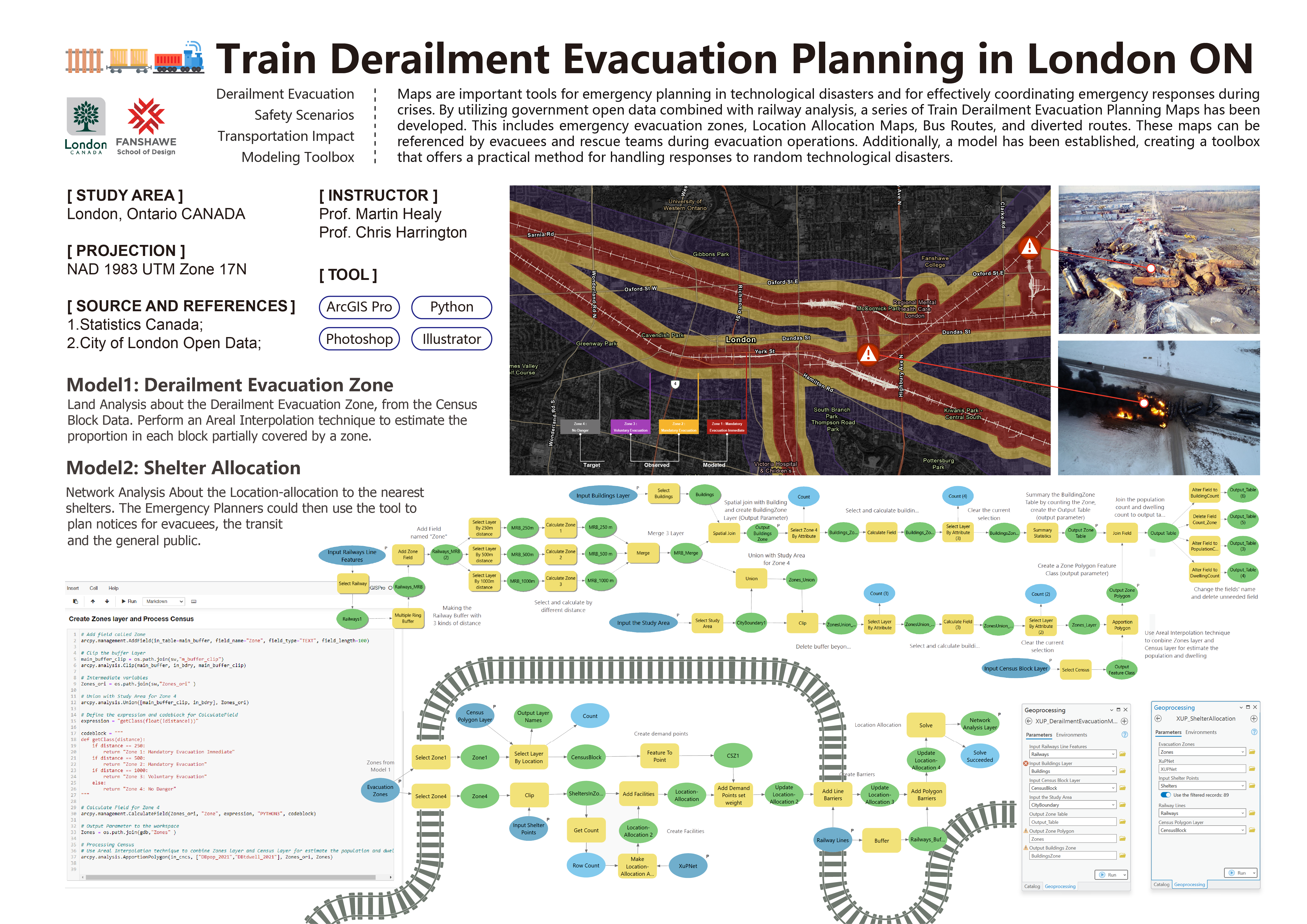
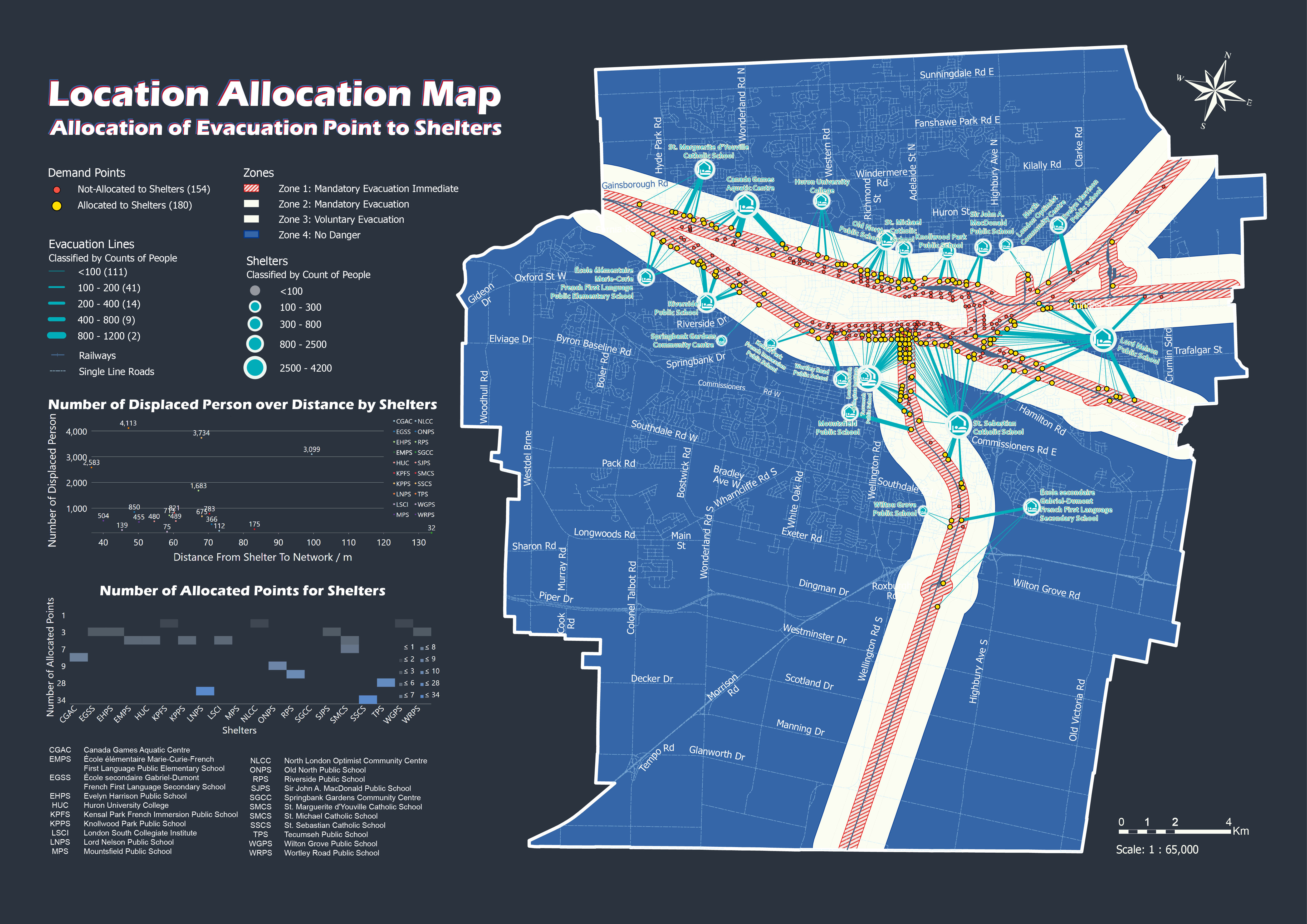
Conducted zoning/network analysis, created location allocation maps and routes maps for evacuees and rescue teams.
Built a practical toolbox using ArcGIS model and Python in Notebooks, for quickly managing technological disaster responses.
Brief
Year: 2023
Location: London, Ontario, Canada
Client: Fanshawe College
; City of London
Tool: ArcGIS Pro, Python, Adobe Illustrator, Photoshop
Background
London, Ontario, has a complex transportation network that includes major railway lines passing through urban and
suburban areas. Given the potential hazards associated with train derailments—such as hazardous material spills,
fires, and structural damage—it is crucial to establish a well-coordinated evacuation plan to minimize risks.
Introduction
Train derailments pose significant risks to public safety, infrastructure, and the environment,
requiring swift and efficient emergency response planning. This project focuses on developing a GIS-based
evacuation planning framework for train derailments in London, Ontario. By leveraging spatial analysis,
network modeling, and automated GIS tools, the project aims to enhance emergency preparedness and response strategies.
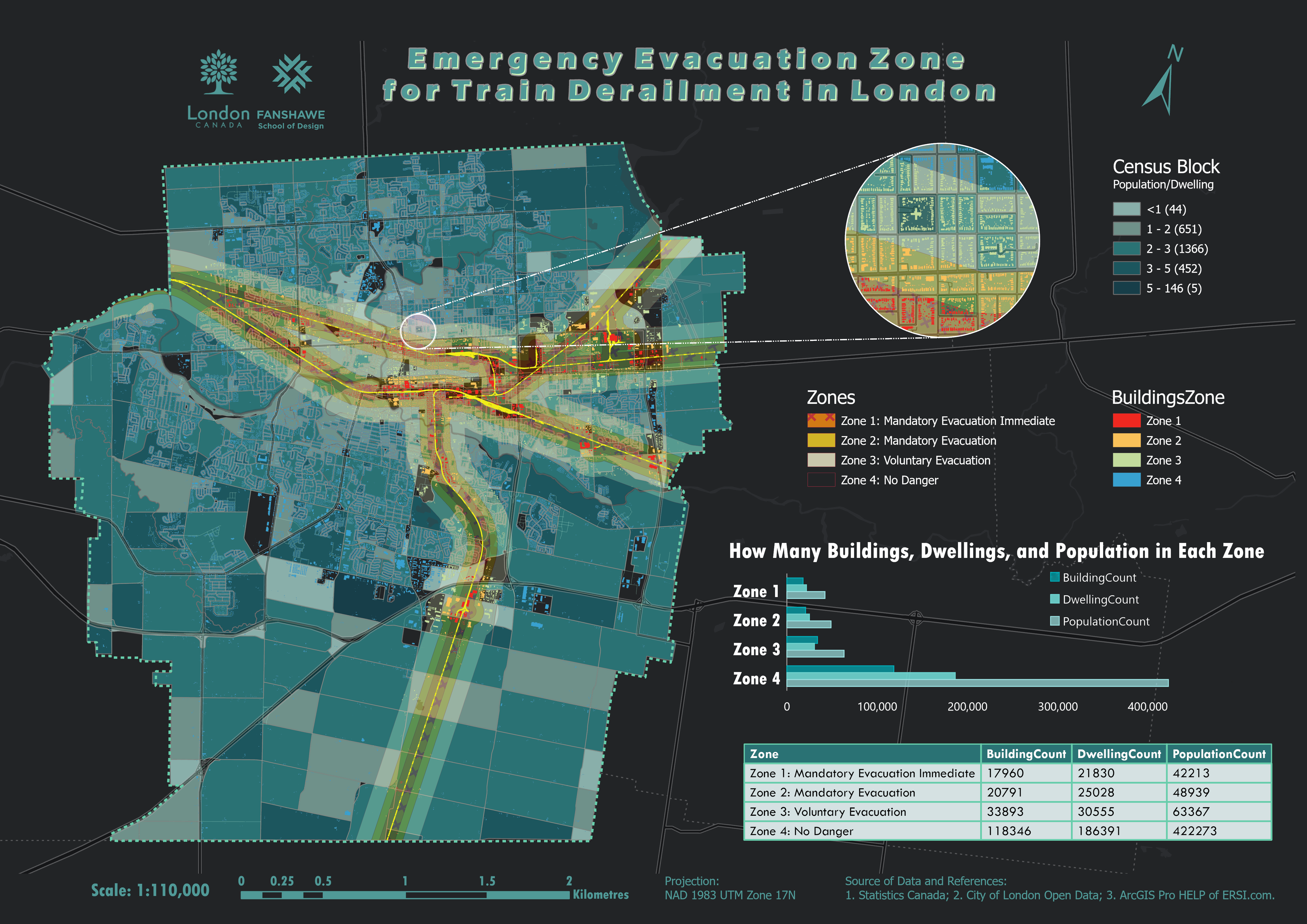
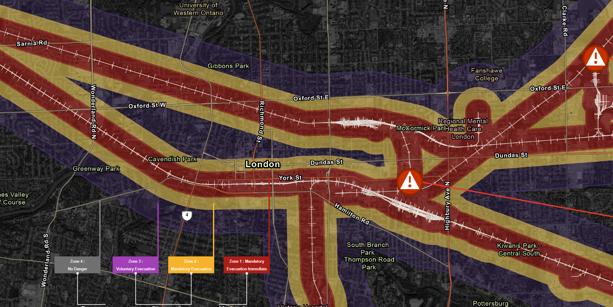
Through zoning and network analysis, the study identifies optimal evacuation routes, assembly points,
and resource allocation plans for evacuees and rescue teams. The project integrates ArcGIS Pro with Python scripting
to build a practical GIS toolbox that facilitates rapid decision-making during technological disasters.