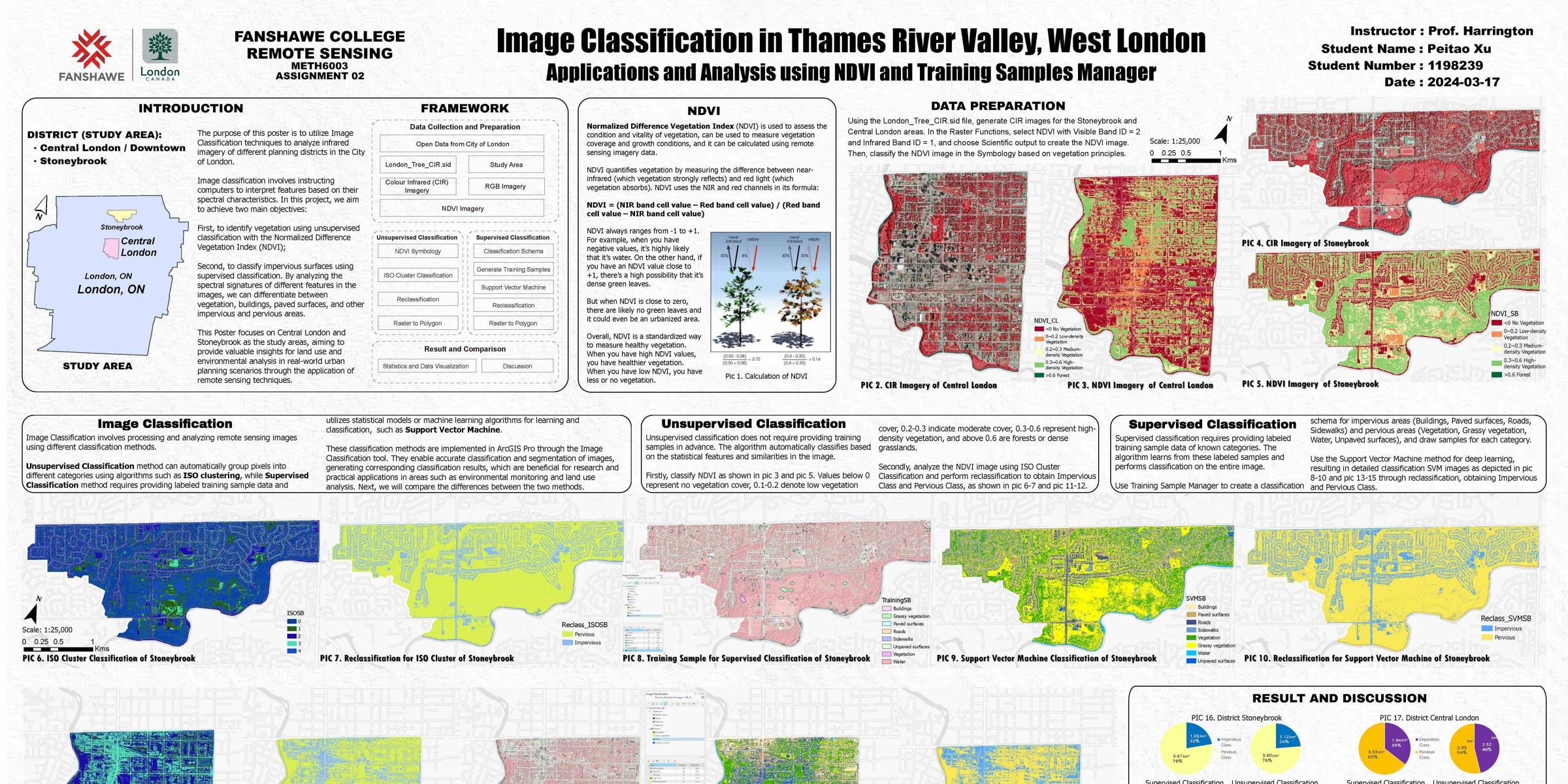
Raster Analysis
in Thames River Valley
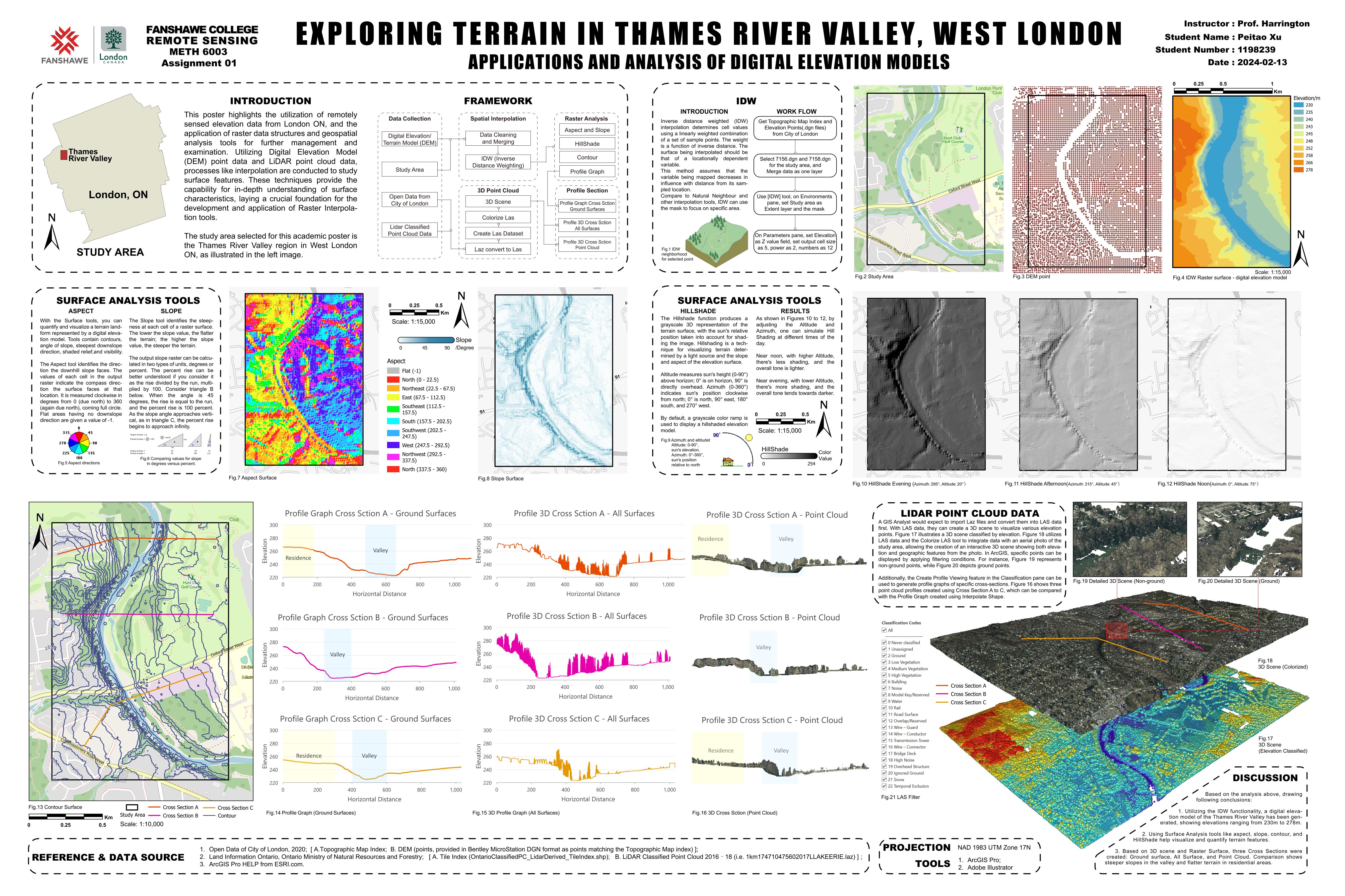
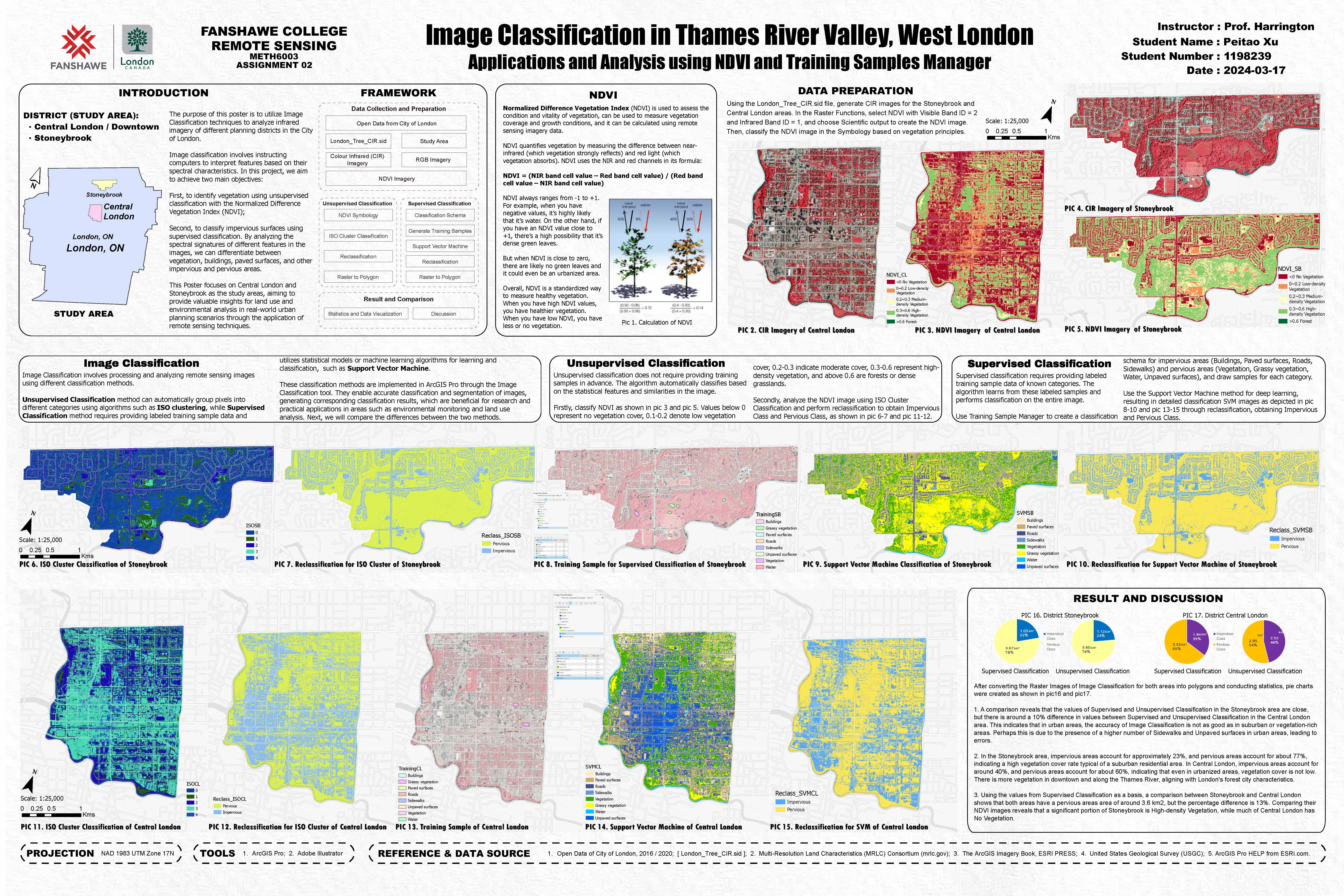
Utilized raster data analysis to assess and visualize the environmental and urban impacts in the Thames River Valley.
Brief
Year: 2024
Location: London, Ontario, Canada
Client: Fanshawe College
; City of London
Tool: ArcGIS Pro, Adobe Illustrator, Photoshop
Background
The Thames River Valley in London, Ontario, is a critical natural corridor that intersects with urban developments.
Human activities, such as urban expansion, transportation networks, and land use changes, significantly impact the
region’s hydrology, vegetation, and ecosystem. By leveraging raster data analysis, this project provides insights
into the extent of urban influence on the natural environment, supporting sustainable planning and conservation efforts.
Introduction
Using raster data analysis, this project visualized the environmental impacts along the Thames River Valley.
It focused on IDW, NDVI, and 3D LIDAR Point Cloud Data analysis to support conservation efforts.
Presented and shared as academic posters, the study provided actionable insights for ecological preservation
and urban planning in Southern Ontario.