NAPS Automation Project
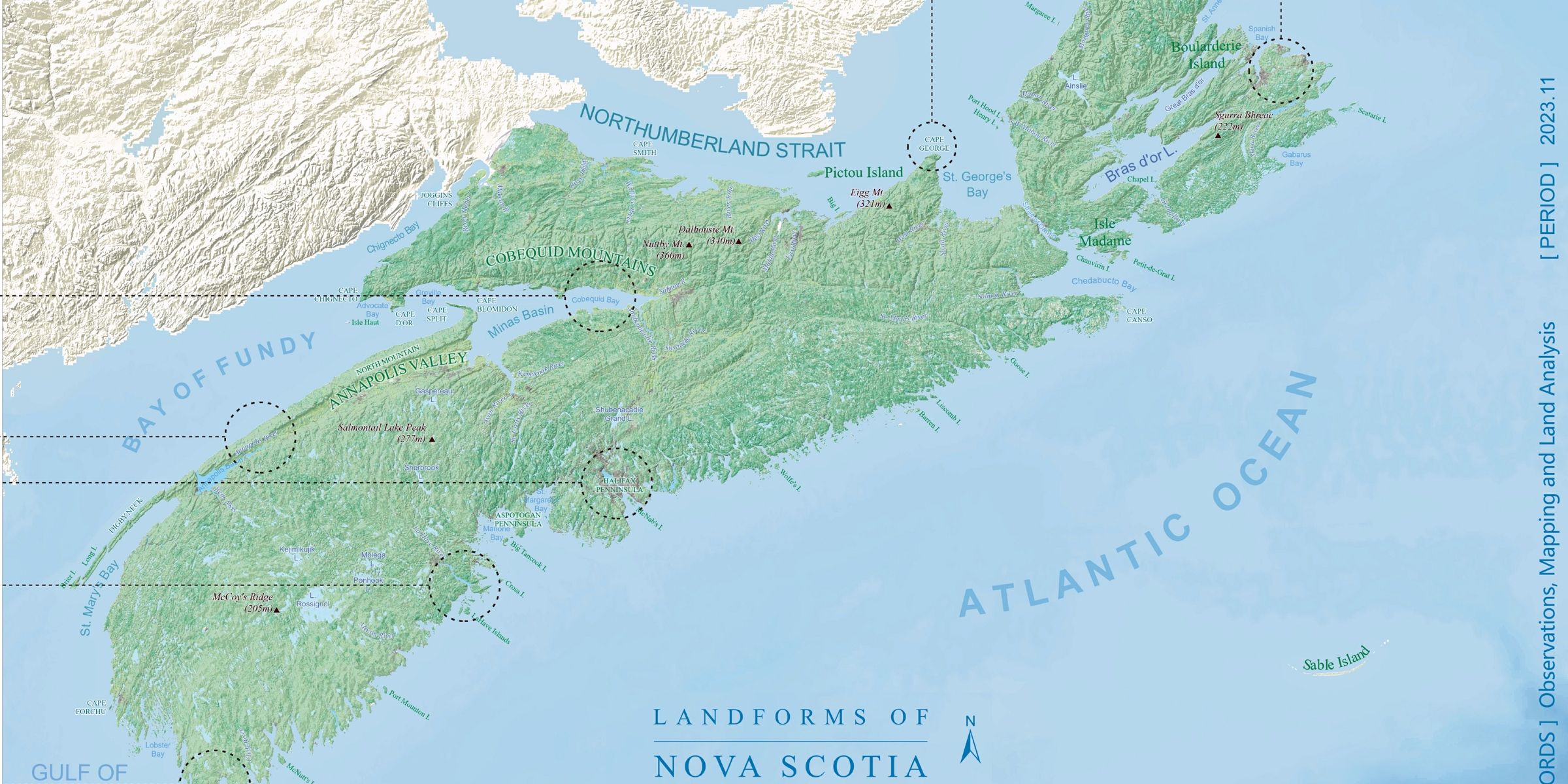
Cartography skills recognized with the GISDay Map Gallery Awards.
Brief
Year: 2024
Location: Ontario, Canada
Client: Ministry of the Environment, Conservation, and Parks (MECP)
; Ontario Public Service
Tool: Python, MS Excel, Tableau
Background
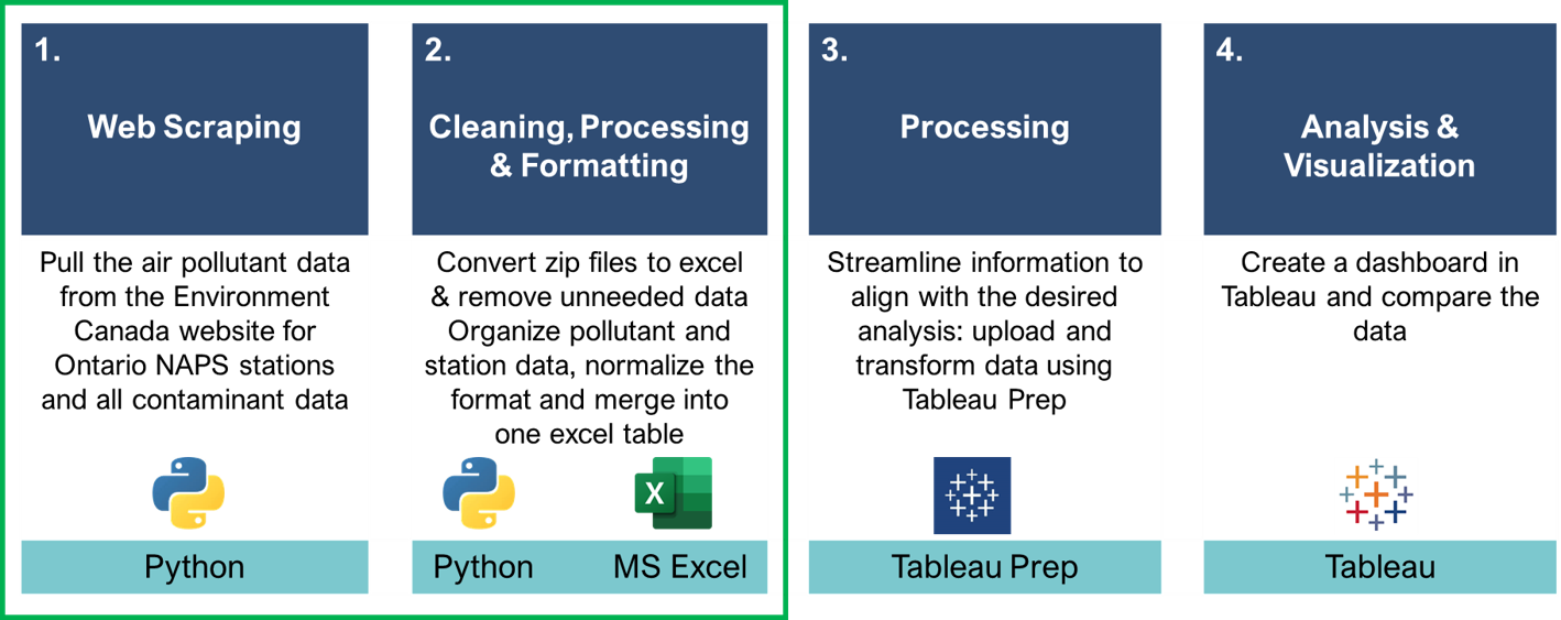
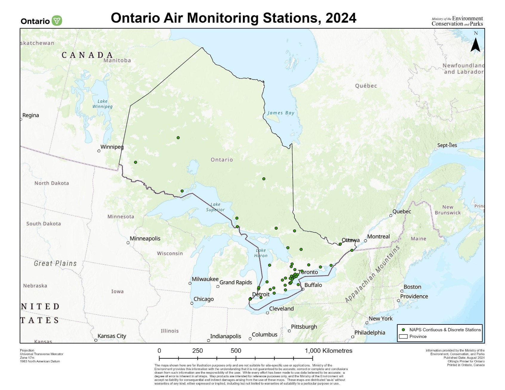
The National Air Pollution Surveillance (NAPS) program collects extensive air quality data across Canada.
Efficiently processing and managing this data is crucial for timely analysis and policy-making.
However, manual data processing was time-consuming, limiting efficiency in reporting and visualization.
Introduction
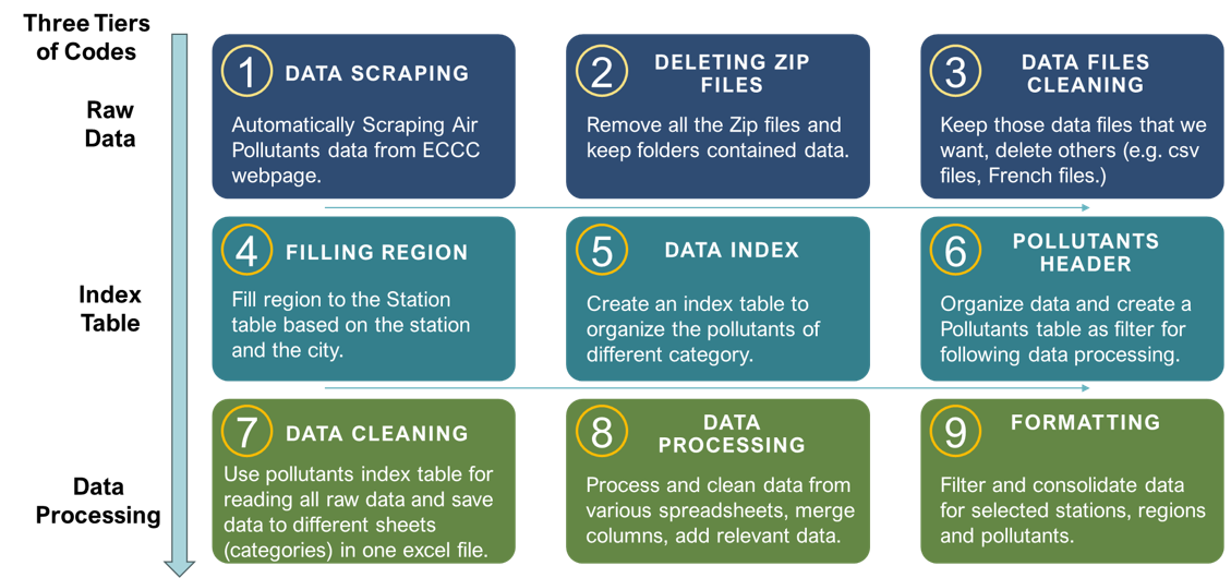
During my work at MECP, I developed an automated workflow using Python, which streamlined the process of downloading
and processing air pollution data. This automation significantly improved efficiency, reducing manual processing time
by 60%, allowing my colleagues to focus more on analysis and visualization.
Working within a team of four, I collaborated effectively, provided weekly progress updates to my supervisor, and
prepared a presentation with demonstration videos to share the workflow with regional colleagues, ensuring knowledge
transfer and smooth implementation.