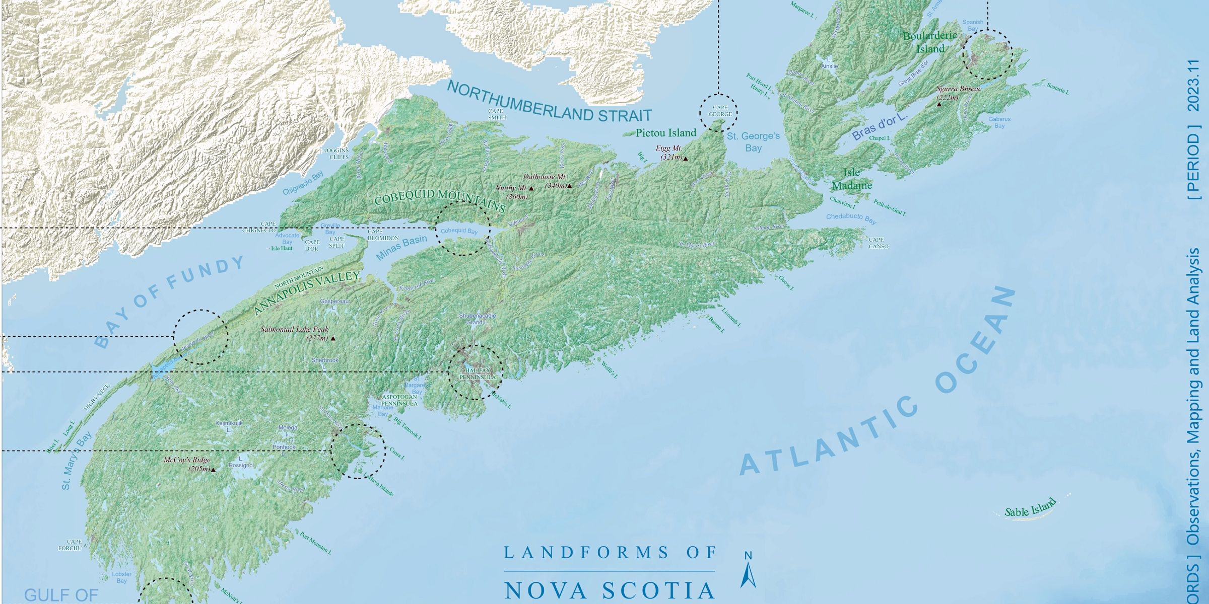
Cartography skills recognized with the GISDay Map Gallery Awards.
Brief
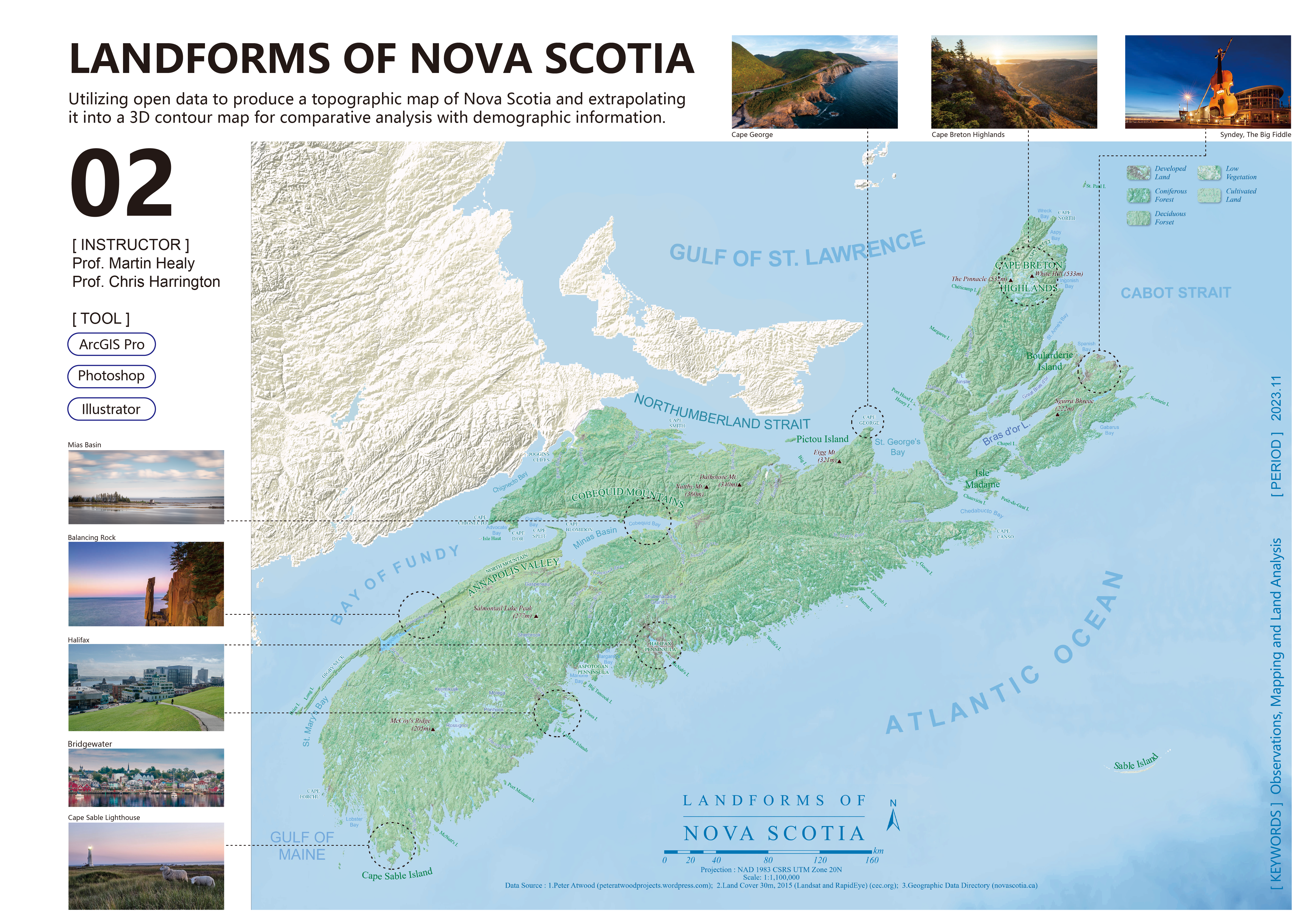
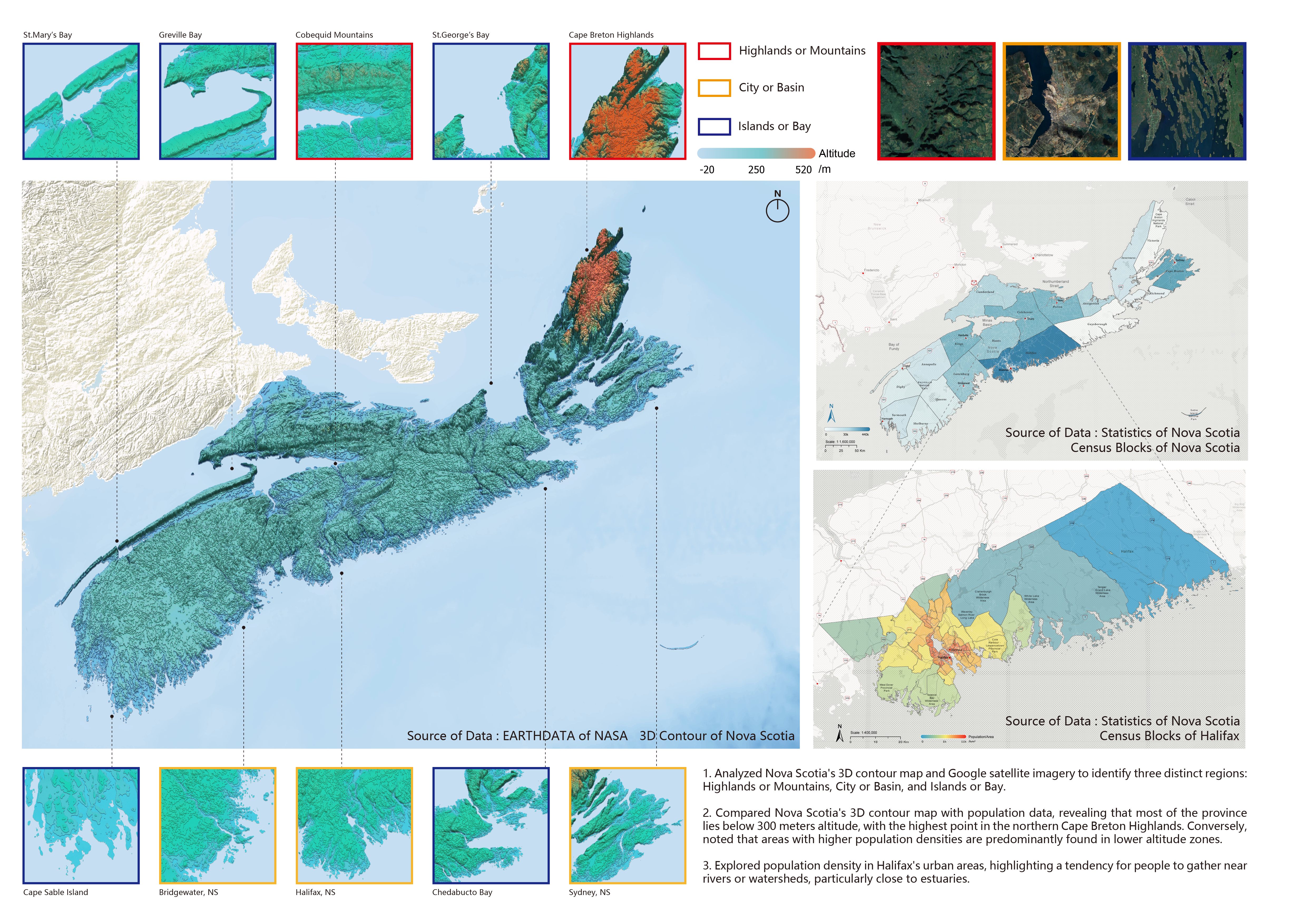
Year: 2023
Location: Nova Scotia, Canada
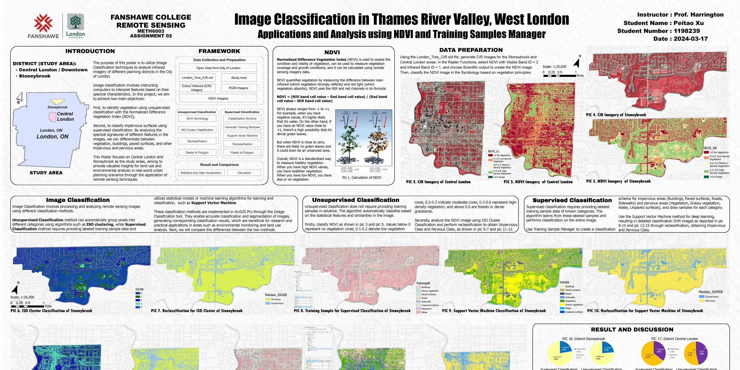
Client: Fanshawe College ; City of London
Tool: ArcGIS Pro, Adobe Illustrator, Photoshop
Background
Nova Scotia’s diverse landforms, shaped by geological history and coastal dynamics,
play a significant role in environmental planning and disaster resilience.
Understanding these landscapes through cartographic representation helps in natural resource management,
urban development, and environmental conservation.
Introduction
This project utilized Nova Scotia’s topographic database to create detailed maps of landforms, including contours,
cliffs, and islands. By combining Raster data with cartographic techniques, I produced visually appealing and accurate
maps that highlight the region’s unique terrain.
This project was recognized for its excellence in cartography during Western GISDays Event.